
 My second full day home after vacation has been fairly uneventful.
Except the weather forecast, which was sunny and warm before I left but has now turned snowy and cold. This means the local orchards have giant fans running to keep their trees from freezing. And since there are three orchards within walking distance of my bedroom, it's been like trying to sleep in the middle of a cyclone tonight.
Which is to say that I'm not able to sleep at all, so I thought I'd blog about two new apps I got for my trip while they are still fresh in my mind.
My iPhone has quickly become an essential travel tool, eliminating the need for maps, dictionaries, guidebooks, and other necessities I usually take with me. Whether I am syncing my itineraries and reservations with Tripit or looking up exchange rates with eCurrency, there always seems to be an app for whatever I need to do. The two latest tools in my travel arsenel have made my iPhone even more essential.
First up is Trip Journal. This handy app allows you to document your travels using the iPhone's built-in GPS to plot your journey and add photos and notes to places you've been (and it can keep tracking, even when data roaming is off). As if that wasn't enough, it's absolutely beautiful...
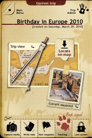
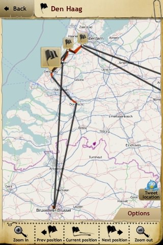
But even better... you can export your GPS tracking data to a KMZ file that can then be imported into Google Earth so you can look at your trip on your computer...

The red lines are when the iPhone was actually able to get GPS coordinates. Whenever a GPS satellite can't be located, Trip Journal just draws a black line to connect the previous point to your current location. This is kind of nice, because the GPS receiver in the iPhone is pretty weak (as you can see by the crazy-ass routes it registers when you zoom in to street level). But putting the lack of pinpoint accuracy aside, you can still see how this would be a really nice and easy way to remember all the things you saw and the places you went while on a trip.
And next up is CityMaps2Go. While not quite as nice and comprehensive as the maps you get out of the Google Maps app that's built into the iPhone, CityMaps2Go has one huge advantage... all the maps are self-contained. This means you don't have to use expensive international roaming charges to load map data. Even better, once you buy the app, you can download maps for most major cities free of charge! Before I left for my recent trip, I just grabbed maps for Brussels, Prague, and Bucharest, knowing that I'd be able to find my way around those cities without having to be gouged for downloading them over 3G...
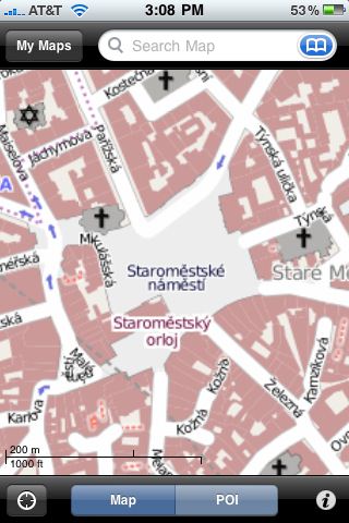
Of course, once you're outside the bounds of the map you've downloaded, you're out of luck and will have to switch back to Google Maps. Still, considering the money I saved overall, the app is still well worth getting.
And there you have it... two more awesome reasons to have an iPhone when you travel.

I love comments! However, all comments are moderated, and won't appear until approved. Are you an abusive troll with nothing to contribute? Don't bother. Selling something? Don't bother. Spam linking? Don't bother.
PLEASE NOTE: My comment-spam protection requires JavaScript... if you have it turned off or are using a mobile device without JavaScript, commenting won't work. Sorry.

If I ever traveled, I would totally use those.
Did you see Thinkgeek’s iPad Arcade Cabinet that they posted today?
Wow. Excellent apps. I don’t travel often enough to get use out of them but I’ll mentally file them away just in case 😉