 As I've mentioned here a few times, I love maps. Because of this, Google Maps is a never-ending source of wonder to me. I could wander around the world for weeks and never get bored. There's just so much amazing stuff to see.
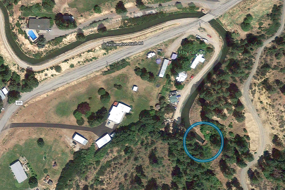
So when I dropped by Google Maps tonight so I could grab directions for some guests I have coming, it should come as no surprise that I got distracted and started poking around my home town in satellite view. It was then I saw something quite odd. An irrigation ditch just outside of town (which I was aware of) seemed to disappear into a big hill (something I was not aware of)...

Image courtesy of Google Maps
If you look in the lower-right there, you'll see that a ditch winds itself around then... poof.
WTF?!?
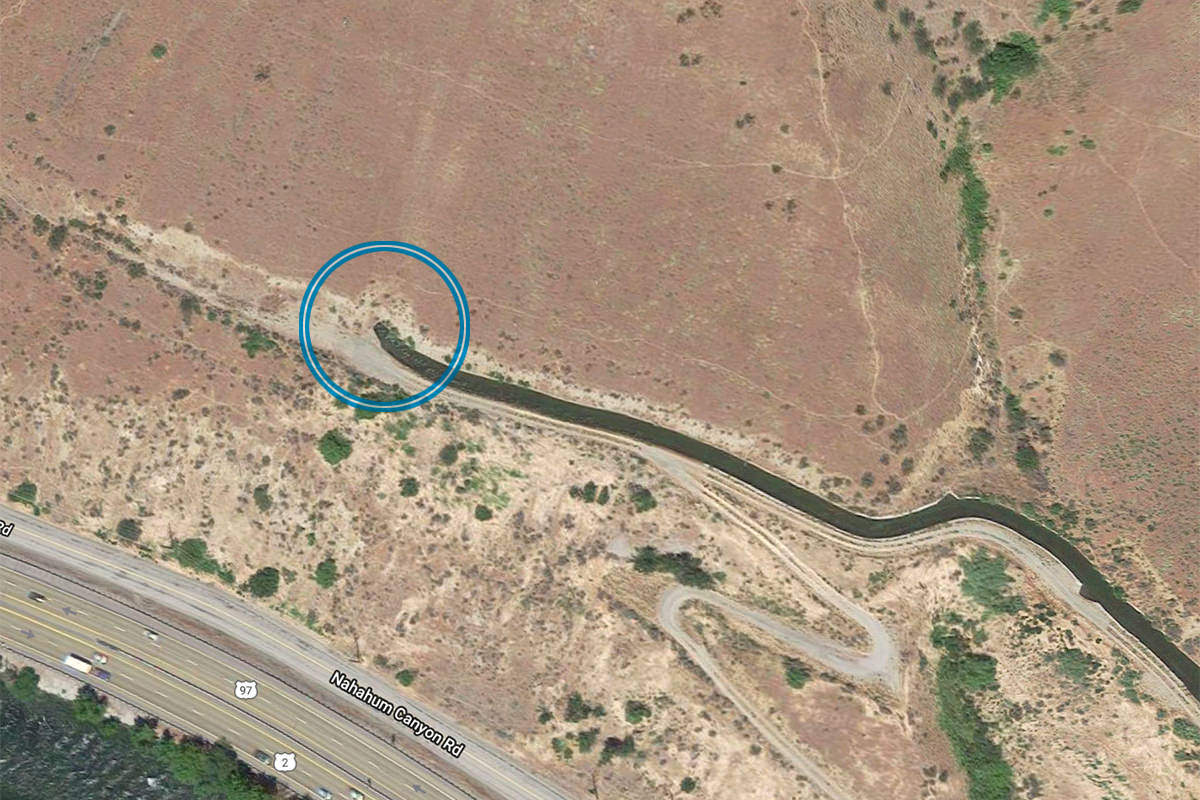
Where did it go? It looks like it goes in a tunnel. But where does it come out? After a little while scrolling around, I found it...

Image courtesy of Google Maps
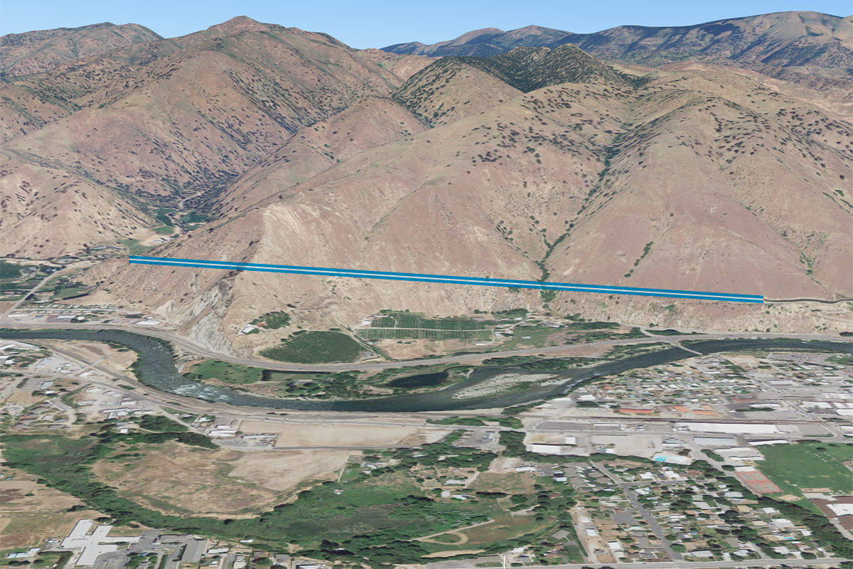
This raises all kinds of questions. Because this is a good-sized hill that it travels through...

Image courtesy of Google Maps
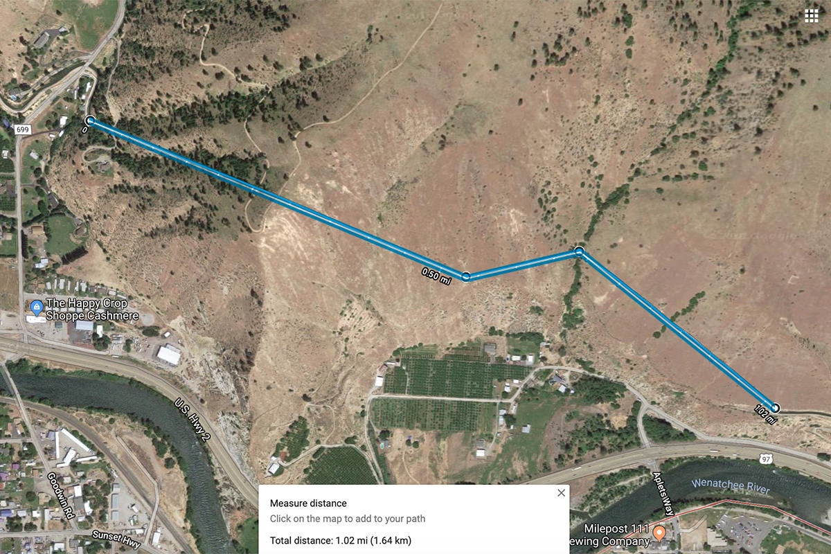
When I traced the path of the tunnel in map view (not a straight line, as I had thought) and measured its distance... the tunnel ended up being a mile long!

Image courtesy of Google Maps
Things like this are fascinating to me.
Is it, in fact, a tunnel? If it is, then when was it built? Who built it? How did they build it? How is it maintained? If leaves and garbage and stuff blocks it, how do they unblock it? And how in the heck can something like this exist without me knowing about it? What other wacky stuff is waiting to be discovered around my home town?
There's only one way to find out...
UPDATE: I found an abbreviated history of the Greater Wenatchee Irrigation District on their website. No mention of the tunnels though. And so... I will continue to investigate.

I love comments! However, all comments are moderated, and won't appear until approved. Are you an abusive troll with nothing to contribute? Don't bother. Selling something? Don't bother. Spam linking? Don't bother.
PLEASE NOTE: My comment-spam protection requires JavaScript... if you have it turned off or are using a mobile device without JavaScript, commenting won't work. Sorry.

I finally had to comment. This is a hydraulic siphon that crosses the canyon. It is a buried pipe or conduit and was done in the 1920s. The entrance normally has a bar screen to keep large items out of the pipe. The pipe is sized to keep the velocities high enough to keep smaller debris suspended so that it will travel to the outlet end which is at a lower elevation than the inlet. There are many examples of this from a toilet to a hose used to siphon water out of a tank.
Do you know if they cut into the side of the hill, put the pipe in, then covered it up again?
Yes they did. Even in the canyon floor. They excavated a lot of times with a horse and large shove device and much hand work. The city’s original pool was excavated that way. There is a picture of the pool work at city hall.
That’s utterly fantastic. Great find and I’d have been lost in questions as well.